

Over the past few years, Tangipahoa Parish has been battered by river flooding, tropical storms, and tornadoes — and the federal government has taken notice.
The Army Corps of Engineers has launched a $3 million study to better understand the increasingly common floods and find ways to mitigate them, from new levees to home elevations. Over the next two years, engineers will be gathering testimony from the public and compiling data.
“The federal interest in Tangipahoa was the fact that they just have had continual widespread flooding caused by tropical storms, hurricanes and riverine flooding from the Tangipahoa [River], Natalbany [River], creeks and watersheds in the parish,” said Kathryn Fechter, a project planner for the study.
The study is a major step forward for parish leaders and residents who have felt besieged by severe weather ever since the 2016 floods.
“We’re really anxious to get it,” Parish President Robby Miller said. “We’ve wanted this since 2016, so we’ll be glad when we get to hear the results.”
LSU researchers who have worked on flooding issues in Tangipahoa Parish note that Miller has overseen more disaster declarations since his last seven years in office than his predecessor Gordon Burgess did in his 29 years as parish president.
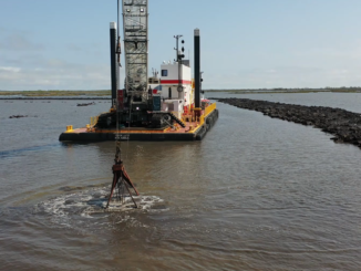
A Corps explanation of the project says the parish has an important economic role in truck farming, dairy farming and the forest industry. It also cites Interstates 12 and 55 as crucial evacuation routes for hurricanes.
‘Hear from folks on the ground’
The study was first authorized in 2020 with the passage of the Water Resources Act. But the Corps didn’t get money to pay for it until last year, when Congress passed the Disaster Relief Supplemental Appropriations Act.
With the study still in its beginning stages, engineers are currently gathering feedback from Tangipahoans about their personal experiences with flooding to get a better sense of what’s happening on the ground. Last month, they hosted two open house meetings in Ponchatoula and Kentwood to hear from residents and business owners.
“We’re in the ‘gathering-as-much-information-as-we-can’ phase,” Fechter said. “We have the FEMA map, but that only tells us so much. We want to hear from the folks on the ground.”
Project planners at the meeting told attendees they intend to have a “Tentatively Selected Plan” by December, which will detail what solutions the Corps plans to pursue for reducing flooding in Tangipahoa.
That plan could involve building levees, elevating homes, creating marshes or some combination of solutions depending on the study’s outcome, Fechter told attendees at the open house.
“Whether it be structural changes to protect things, new drainage, retention ponds or even reservoirs, they’re looking at every option to improve drainage along the river,” Miller said.
A similar feasibility study in St. Tammany Parish produced a draft report that recommended $4 billion worth of flood proofing measures: building 14 miles of levees and two miles of floodwall in Slidell, clearing Bayou Patassat, improving channels in Mile Branch and elevating about 8,500 structures in the parish.
After facing pushback from some groups in the area about its effectiveness, the Corps received an additional 16 months and $1.77 million back in June 2022 to fine-tune the study.
Fechter said the Corps will host additional open house events during the summer to gather additional comments from flood victims in Tangipahoa. The project is slated to conclude in October 2025.
Years of disasters
Flooding is a decades-long problem facing Tangipahoa Parish.
In 1983, thousands lost their homes to floods caused by heavy rainstorms across the Baton Rouge region. The victims in Tangipahoa, who are just getting compensated by the state four decades later, attributed parish flooding to the newly-built Interstate 12, which failed to cross the Tangipahoa River at a higher elevation and disrupted the natural flow of waterway systems.
From 1978 to 2018, the Federal Emergency Management Agency doled out over $61 million for repetitive loss claims in the parish.
Since 2020, Tangipahoa has had disaster declarations for hurricanes Laura and Ida and tropical storms Marco and Cristobal.
Hurricane Ida alone dealt a devastating blow to Tangipahoa, knocking out power parishwide and decimating trees, homes and powerlines. Over 20,000 homes were damaged, and over 390 miles of waterways were clogged with debris.
Many of those displaced were still recovering from the devastation of 2016’s floods, when two separate historic floods in March and August caused major damage to 12,700 homes and 1,500 businesses in the parish.
Over $17.4 million in productivity were lost, according to the Corps.
Leave a Reply