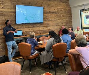
Zachary Planning Director Bryant Dixon was the guest speaker at the Zachary Rotary Club.
Dixon demonstrated the GIS mapping technology available on the city’s website. This mapping system gives governments and residents access to information they need to make more informed decisions.
Residents can learn more about their property and other property in East Baton Rouge Parish, such as council districts, jurisdictions, flood zone, school districts and wetland areas.
Residents can navigate further for detailed property information, such as lot number, subdivision name, zoning district and garbage/bulky waste pick-up days.
To use this informational tool, visit https://ebrgis.maps.arcgis.com/home/webmap/viewer.html?webmap=7ad949645e6844469fe1b641f407994f.

Leave a Reply